My 1983 Appalachian Trail Hike in Photos
I wrote a ton in words in my journal as I hiked the Appalachian Trail. I also shot a ton of Kodachrome slides in that pre-digital age. I've scanned all my old AT slides and posted them with short text blurbs connecting them to their parts of the story. I'd never tried to connect all these slides with all these words before. It helped me remember details of that long-ago hike in new ways. These pages are a chronological visual journal of the hike. Probably one of the oldest thru-hikes on the Internet to get one.
More pics from my 1983 Appalachian Trail hike. Table of Contents is here.
Camp Creek Bald, NC / TN - Little Hump Mountain, NC / TN

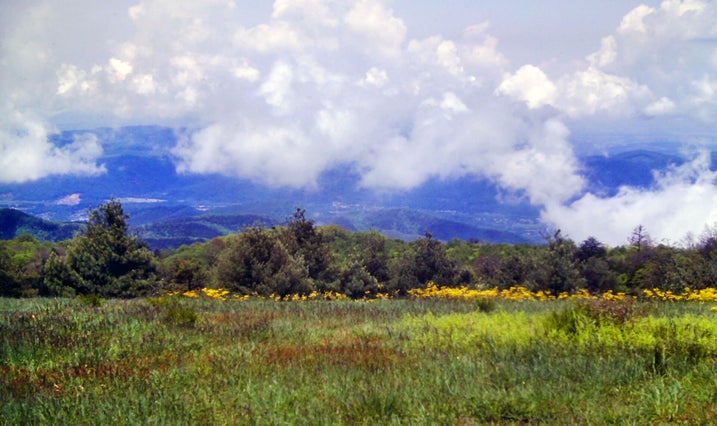
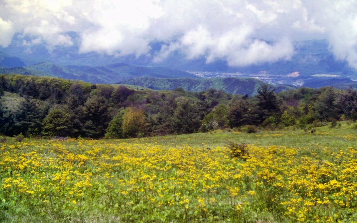
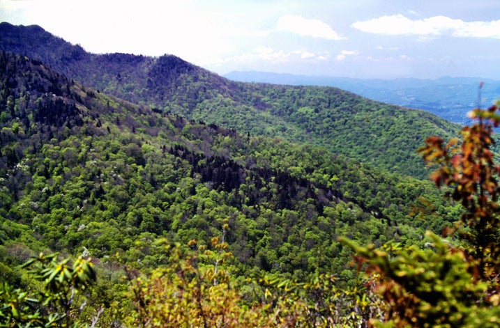
Picking up where we left off at the bottom of the previous page, this pic is also from May 27, 1983. The side trail to White Rock Cliffs was a couple of miles past Camp Creek Bald. By this time the breathtaking blue of the sky on that day was even somewhat apparent along the far horizon.
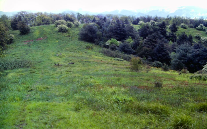
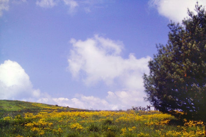
Since a little past Fontana Dam, NC, the Appalachian Trail had been mostly following the western fork of the Blue Ridge along the North Carolina - Tennessee border. Several mountain ranges comprise this state line ridge. The first I traversed was the rainy Great Smoky Mountains - the Dark Lands from Chapter 3. I had better, but not perfect, luck with weather in the next range, known as the Bald Mountains. Also, gorgeous views from places like this. Since I like to dwell on the positive, I named Chapter 4 - the first Bald Mountains chapter - Heartbreak Hotel. We are still in Chapter 5, which covered the rest of the Bald Mountains.
The first open cliffs I could remember seeing on my entire Appalachian Trail hike overlooked a scenic valley in the North Carolina foothills.


A few tiny cirrus clouds had made their way into the previously unbroken blue expanse of the sky. But that blue was still amazing.
At about two-and-a-half miles past the side trail to the cliffs, the Appalachian Trail joined a jeep road, jolting my plans for tonight. When I had read about this road in the guidebook, I expected the customary long-abandoned, overgrown track. This one showed all of the signs of still receiving constant use, which meant that Jerry Cabin Shelter, at which I had planned to stay, was accessible to motor vehicles. This usually means trouble for hikers attempting to sleep, and tonight was a holiday weekend Friday night. I had a problem. It was 6:00. I had come fifteen miles today, and the next shelter was six miles away.
Two local guys were at Jerry Cabin when I arrived. They confirmed that other locals did come up here on weekend nights to get drunk and stoned while yelling and shooting their guns all night.
I like to avoid stoned people with guns when at all possible, so I needed to make other plans. He told me about a good campsite up the road a mile-and-a-half and invited me to join his friend and himself there tonight. I readily agreed.


Our campsite was in an old field atop a summit called Big Butt (write your own punchline here). After I pitched my tent, one of the local guys asked me if I wanted to see a couple of nice views. They were excellent.
One more from White Rock Cliffs, May 27, 1983.
When I got back to my tent, it was pitch dark. I did not feel much like cooking. I had a cold dinner of Pop-Tarts, cheese, and crackers and crawled into my sleeping bag.


The next morning, May 28, 1983, I woke up to discover that it was already fairly bright outside. A huge full moon directly overhead was blazing so brightly that it had appeared to be morning from inside my tent.
I woke up again at 7:00 and emerged from the tent just as the sun was about to come up over the trees. The sky was clear except for a slim band of clouds along the western horizon.
I began to make breakfast. Within five minutes, the entire sky was overcast from one end to another. It was amazing.
I headed out at 8:30, stopping to say good-bye to my two friends, who had slept in an empty shack across the field. I felt played out and could not get going -- a feeling that would stay with me all day.
Chapter 5 of the book.


I followed the jeep road through an overgrown field where two gravestones were covered with fresh flowers. They marked the graves of a couple of local men who fought for the Union side in the Civil War and were killed in an ambush by Confederate loyalists while attempting to go home on leave.
May 28, 1983 was rough and far less rewarding than the previous day. Thickening haze and clouds replaced that clear blue sky.


There was a steep, gut-wrenching descent on the jeep road off of the mountain. I passed Flint Mountain Shelter at 10:45 -- the last shelter for twenty-seven miles. The clouds above were thickening and continued to do so as the day wore on.
I finally reached Devil Fork Gap, feeling tired and cranky.
The next stretch was even rougher -- seven-and-a-half miles of hell, the hardest trail I had hiked since the section before Fontana Dam.


It began with a short climb and then a long, vertical descent that made my knees ache. I almost fell down the last steep pitch near the bottom.
I came out onto a short roadwalk past some mountain farms.
This was followed by a long stretch of steep climbing straight up a mountain. I was too tired to attempt to stop and then try to get going again. I had to make the whole climb in one shot. I tuned out my mind to the growing pain in my legs as I struggled along for more than an hour.
Still May 28, 1983, Saturday of Memorial Day weekend for most not hiking the Appalachian Trail. Chapter 5 of the book.


I finally made it to the top of a knob with no views and began a descent alongside a barbed-wire fence into a sag.
That was where I was finally rewarded for all of the mindless climbing.


Incredible views from that grassy little sag continued all of the way up a sloping meadow to the main summit. I wiped about a pint of sweat off my camera's viewfinder and started shooting pictures.
Still May 28, 1983. Chapter 5 of the book.
The trail descended on fairly reasonable grades into Rice Gap and then climbed an overgrown jeep road straight up another slope. The trail began to go up and down like a roller coaster for a while, before a steep grind led to a summit named High Rock where there were no views. God, it sucked. The descent from High Rock involved long, abrupt drops mixed in with occasional sharp climbs up knobs. I finally reached Sams Gap, having covered fifteen miles.


I had read in the last shelter register that many hikers have been sleeping in an abandoned building there, but the place was all boarded up and I could not find a way in. I would have to go on and tent in the rain tonight.
The Appalachian Trail climbed from Sams Gap up to the summit of another knob. Open fields along the summit and along the ensuing half-mile descent provided great close-up views of Big Bald.
I eventually made it to a campsite at Low Gap, having come eighteen miles May 28 over harsh terrain. I pitched my tent, made a huge dinner, and climbed into my sleeping bag. As I wrote the day's journal entry, the rain began to fall. At least it held off until I was prepared. I passed the 300-mile point of the Appalachian Trail this day.
Still Chapter 5.


The next day, May 29, 1983. I had pitched my tent in Low Gap, at the base of the climb up a mountain called Big Bald. I was looking forward to the views from that open ridge crest. Sunday dawned foggy and drizzly but seemed to be trying to clear. Exhausted from the grueling previous day, with a somewhat easier day planned, I decided to wait until late morning if necessary to begin my traverse of Big Bald.
The sun actually burned through the clouds a couple of times as I was getting ready to leave. The only problem with that was that both times it did so, a heavy rain started up. Each time, a cloud moved in front of the sun five minutes later and the rain immediately stopped.
I began hiking exactly at 11:00 beneath a heavy overcast, but no rain. My first three miles were the climb up Big Bald; I knew from experience that the weather would progressively deteriorate as I gained elevation. I was right. Within a half-mile, I was in a light drizzle which soon became steady. The grades were excellent -- a rare treat recently -- and I made good time.
Nearing the summit, I actually broke out into better weather. The sky brightened and I was approaching the top of the cloud. Were that cloud a little lower or that mountaintop a bit higher, I would have enjoyed some nice views.


Walking across the open summit was still an experience. It was an immense grassland sprinkled with sparse, scrubby bushes. The wind was whipping shreds of cloud across the desolate landscape. I felt as if I were on a Scottish moor as I strolled over the summit and started down the other side.
There must have been about a mile or so of open fields. Towards the end, I came across a grove of strange, misshapen trees whose structures were contorted into all kinds of crazy angles. They rose from out of the fog like a cluster of arthritic limbs.
Still May 29, 1983. Chapter 5 of the book.


Around 1:00, about a mile past the summit, I came upon a man and a dog sitting beside the trail. It was Ron and Sonny. It was good to see them again, and I talked to Ron for about an hour.
When I resumed my hike, I climbed over Little Bald, from which there were a few views, and descended steeply into Whistling Gap. The sun had come out while I was with Ron, and things were looking up as I ascended to High Rocks.
The descent into Spivey Gap brought my mood down just a little. It had many steep pitches, and hiking over the muddy clay along the trail was like walking on ice. The Appalachian Trail was extremely difficult to locate as it climbed out of Spivey Gap, and the footway was a quagmire alongside a stream with mud that oozed up over the tops of my boots. The trail remained obscure for the next mile.


As I was skidding recklessly down a precipitous clay slope through a tangled jungle of rhododendron into Devil Fork Gap, the sky began to darken once again. I virtually ran the final three miles to the shelter. It was of no use. A fast-moving thunderstorm caught up while I was still a mile away and drenched me to the bone. I may have uttered a few mild oaths as I squished soggily along the trail. Just as the shelter was coming into view, the rain suddenly stopped.
Four guys from Tennessee had preceded me to the shelter. They quickly and courteously made room. We were soon laughing and joking and having a good time as we made our suppers. One of the fellows had whipped up a large cherry cheesecake, and they were nice enough to save a piece for me. This was in spite of the fact that I had just polished off a huge dinner, and my eyes lacked their usual lean, hungry thru-hiker look. I loved the people I met in those mountains.
This ends May 29, 1983. Still Chapter 5 of the book.


Monday, May 30, Memorial Day 1983: My new friends made pancakes in the morning. They were returning to their car that day and wanted to rid their backpacks of all unnecessary weight; they told me to keep my food in my pack and they would feed me. Hey, I was only too happy to help them out. They left at about 11:00, while I stuck around for a while longer.
I had a mere seven-mile walk remaining to the establishment where I intended to stay: Nolichucky Expeditions, a whitewater rafting outfit in Erwin which allows hikers to camp in their field and use their hot showers for two dollars per night. I figured that Memorial Day would be an extremely hectic day for the outfitters, so I decided not to arrive there too early.
The first couple of miles of my short day were an easy, level hike along the side of No Business Knob, passing through yet another dense, scenic rhododendron jungle. I was compelled to force my way through a great deal of overgrown foliage along the trail, and many blowdowns had to be gone under, around, or over, but these were all minor inconveniences.


The next mile was an easy climb followed by an easier descent. This was succeeded by a well-graded climb up a logging road to a ridge, along the crest of which the Appalachian Trail briefly roller-coastered over a series of knobs. Then came a long, steep descent along a narrow spine with great views into the valley of the Nolichucky River below. This final ridge was covered with mountain laurel just beginning to bloom.
The Bald Mountains ended at the Nolichucky River. Across the river, on the left and top sides of this pic, the Unaka Mountain Range begins.
Still May 30, 1983. Still Chapter 5 of the book.
As I neared the end of the descent, I was rewarded with this sweeping view of virtually the entire town of Erwin, Tennessee. If you look real hard and squint your eyes you can almost see the Pizza Hut "two miles further down the road."
This ends May 30, 1983 and Chapter 5 of the book.


After spending much of Memorial Day, 1983 and much of the day after in Erwin, Tennessee, I closed out May Tuesday night with a 3-mile, 1400-foot climb out of Erwin to Curley Maple Gap Shelter. I was now in the Unaka Range of the state line ridge.
May 31, 1983. From Chapter 6 of the book.
The path climbed through a grizzled jungle of hemlock and rhododendron. The latter were just beginning to bloom -- the first I have seen on this journey. Mountain laurel like those pictured here were also starting to bloom. Full Spring was arriving, even at these higher elevations.

June 1983 came in like a lion. June 1's morning started with drizzle and soon was a slog through pouring rain and howling wind. Then:
Swirling winds tore through the thickening fog and the rain intensified as I climbed towards a peak known as Beauty Spot. Just as I broke out onto the large rolling meadow surrounding the summit, the rain abruptly and completely stopped.
By the time I had made my way down to the edge of the woods on the other side, the clouds had begun to shred apart in the teeth of that wind, revealing steadily improving vistas of green mountains and valleys.


By this time, the rain had just stopped but the wind was still howling.
I dropped my backpack and climbed back up to the summit. The wind faded to a good, fresh breeze. Soon, I was basking in sunshine, watching little tatters of cloud drifting off into the sudden blue sky.
Still June 1, 1983. Still Chapter 6.
Note the cluster of four trees at the bottom of the long sloping meadow visible in three of the last four pics. I had backpacked over the summit and descended this slope. The edge of the forest just beyond is the point where I had progressed when the clouds began to shred, and the views appeared.


I dropped my pack and climbed all the way back up this slope. I never regretted it.
I shot this pic and the preceding 2 pics from basically the same spot. The first 2 are obviously uphill and downhill along the ridge crest. This one is looking down the side of the ridge into the valley below. Stitch them together in your mind and you'll get an idea of the panorama surrounding me on Beauty Spot June 1, 1983.

Once the sun broke out, the remaining clouds began to dissolve before my eyes. The wind quickly diminished, although it remained breezy.
I have seen many rainstorms end in my life, but I have never seen a storm just collapse like this one had. Within a handful of minutes, the day had gone from rainy and cold and windy to sunny and warm and breezy. Those cool lingering clouds in these photos were visibly shrinking right before my eyes.

I spent an hour up near the summit of Beauty Spot, which I had all to myself on the first day of June 1983. Then it was time to move on. Still Chapter 6.
A dirt road to the summit culminated in this scenic little circle. No one had attempted the drive this morning in the wind and rain.

My visit to Beauty Spot wound up being one of my favorite memories of the entire hike.
In addition to the perfectly timed amazing weather transition, I also managed to arrive the day of Beauty Spot's peak wild daffodil bloom in 1983.
I was raring to go after several days of slowing down so I wouldn't reach the mail drop in Erwin while the P.O. was closed for the Memorial Day weekend. The terrain was rugged, with a long climb over Unaka Mountain and a series of roller-coaster knobs and gaps. I had almost a month of conditioning my out-of-shape body behind me, so I pushed on for 21 weary miles - a tough slog with a food-heavy backpack two days out of a town.
I was just about down on my hands and knees crawling when I finally reached the side trail to the Clyde Smith Shelter in deepening twilight. It was a long access trail. Naturally, the shelter’s water supply was a long way down a steep mountainside. I do not know how I made it back up. I had a huge dinner, wrote a long journal entry and went to sleep.
Still Chapter 6. End of June 1, 1983.

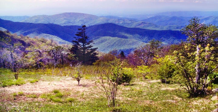
June 2, 1983. Chapter 6 of the book. The trail was rough. The mile from the shelter to the cliffs on Little Rock Knob was straight uphill. Another gorgeous day and a nice series of views made that climb worthwhile. Little Rock Knob was an interesting name for a mountain that missed five thousand feet in elevation by less than a hundred. The middle name fit, though. The rocky cliffs provided great views, especially into Tennessee.


The state line ridge made a ninety degree turn at Little Rock Knob, providing an expansive panorama north and east. This part of eastern Tennessee was a rolling country of mountains and farm valleys. A patchwork of terraced fields and green pastures climbed well up the otherwise forested slopes.
It was a fitting start to two of the most scenic days of my entire hike. I made my way along the cliffs feeling tired but exhilarated — three words which describe my condition over much of the course of the day.
After the straight uphill climb to Little Rock Knob came a sharp plunge down. From the bottom of Hughes Gap, I began the fabled ascent of Roan Mountain.
A few more pics from Little Rock Knob for you as I climb Roan.
Still Chapter 6. Still June 2, 1983.


Roan is a sprawling mountain. The scenic section of the Unaka Mountains I would be passing through today and tomorrow, known as the Roan Highlands, stretches for about twenty miles. I will be covering more than ten of those miles on the Appalachian Trail.
More than half of the Roan Highlands is the main ridge crest of Roan Mountain running roughly east-west with five main summits.


It also throws out several impressive side ridges with significant minor summits. I was climbing one of those now, heading southward towards that main crest.
The initial climb out was deceptively mild, but the endless slope gradually became steeper. I just had to turn off my mind and keep plodding ahead until the trail leveled off atop Beartown Mountain — a minor summit of Roan. A short side trail led to a decent viewpoint up there, but my legs felt like they had just tackled Everest.

There was also a good view of Roan's main ridgeline from Beartown. I was most of the way up at this point, but there was some more climbing to do.
The AT dipped down slightly into Ash Gap and followed moderate grades from there almost to the crest of Roan, but one more thigh-killer was lurking right at the end.
Finally, I dragged myself onto the crest of a grassy little knoll and the sprawling summit plateau unfolded before me. I crossed a paved road which came up from the valley below and came upon a roadside picnic area with tables, trash cans and water fountains. It seemed a perfect spot to take lunch and to regroup.


In addition to a beautiful fir and spruce forest, there were wide grassy areas sprinkled with bluets and other early Spring flowers. Roan Mountain was the last 6000-footer on the AT until Mount Washington in New Hampshire, so the season way up there was much less advanced than the June 2 date might suggest.
I also passed large swathes of the wild rhododendron for which Roan Mountain and the surrounding Roan Highlands are famed. It was too early in the season up there to catch them in bloom. In addition to the rhododendron, the highlands are known for large stretches of grassy bald.
June 2, 1983 was one of those crisp, sun-washed days when the sky just seems to sparkle.


A paved road ran through Carvers Gap; many cars were parked adjacent to the AT crossing. The trail up Round Bald, the next summit of the Highlands, was packed with day hikers wearing parkas and other heavy winter clothing. They must have thought me strange in my shorts and tee shirt.
It was a chilly day to be standing around, but a nice, steep half-mile climb sort of gets your blood going. Few of those people made it very far before the coats, hats, and gloves started to come off.


None of the day hikers continued past Round Bald; I was alone on the open ridge for the rest of the way.
Still Chapter 6. Still June 2, 1983.
Beyond Carvers Gap, for more than two miles, the ridge crest was a long, undulating meadow sprinkled with thousands of bluets.


This all helped take my mind off my tired legs, the still open wound on my right little toe, and my frustration that I wasn't yet reaching the pace I needed to reach Katahdin before the potential first snows.
But all these, combined with the physical effects of unaccustomed high elevations, left me in a rather black mood later that night when the hike was over for the day.
The blackness returned once more the next night but greatly abated once I left the higher elevations.


Starting with Round Bald, the final three summits of Roan Mountain, which also included Jane Bald and Grassy Ridge Bald and the connecting ridge crest, was basically one long meadow. This is the longest continuous stretch of grassy bald in the Appalachians.
Still Chapter 6. Still June 2, 1983.
Round Bald and Jane Bald's summits were both over 5800 feet. The ridge crest in between did not dip down very much.

It was a varied and interesting grassland, with great views the whole way. It was an exhilarating day, but the relatively high altitudes did have an effect on me physically and mentally. I would feel it that evening.
A couple of gnarled small trees or large shrubs managed to grow in this large grassy expanse. They were not showing any signs of life at the moment, but it was still early Spring up here.
Still Chapter 6. Still June 2, 1983.


Along the ridge crest there were constant views of North Carolina Route 261 winding up through the foothills to meet Tennessee Route 143 at the ridgeline in Carver Gap.
There were a few small villages in the valleys between the Tennessee foothills.


Although they were the same height, Jane Bald was smaller in area than Round Bald. There was a little more scrub, but still plenty of views.
Both state roads paralleled the ridgeline for a while, but eventually they both headed down their respective mountainsides.


June 2, 1983 was one of the most scenic days of my entire Appalachian Trail hike, and another day just like it lay ahead, but it was starting to get late. Time to find a place to spend the night.
I'm still not done. More AT pics here.